UK (78) . Wales (40) . South Wales (18) . Brecon Beacons (4) . Black Mountains (1) .

Black Mountains Classic

Grade: Black (Severe) Black (Severe)
Distance:38.70 km
Ascent:1050 m

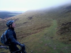
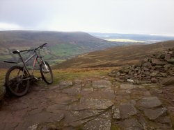
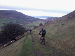
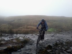
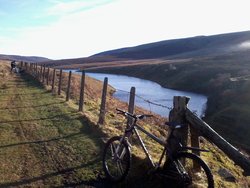
This is a wild ride over the highest part of the Black Mountains, reaching 700m and crossing some desolate country.

The western leg is grassy and smooth, with a long, steady climb up from the south and a fast descent. A twisting climb is followed by an 8km descent along rough singletrack and bumpy doubletrack. The final climb through the forest will be tough on tired legs, but the final descent from Crug Mawr is well worth it.

Looking back from just below Point 617.

Download GPX file

Postcode: NP8 1SR

Route Details

  1. There is limited parking by the bridge, or 3km south at the Llanbedr junction. The short, rough climb though the farm isn't a bridleway, so push up and save your legs. As you reach open land the bridleway keeps right and passes through a wood. Beyond, the going is tricky for 2.5km, with numerous small streams giving technical interest. If it's wet you might be better of on the road that runs parallel. When the tracks merge ther surface improcves and it's a long, steady climb to the col at 617m.
  2. From here the more northerly bridleway does not exist on the ground, so follow Rhiw Trumau across open moorland, and a short steeper rocky section to reach the mountain fence. Contour right, above the fence to cross a stream with a push out, then some fast singletrack takes you to the end of the fence and a steep descent to ford Rhiangoll. Soft ground then a steep push takes you to a fabulous viewpoint on the ridge of Y Grib. Push up east until eventually you can ride the soft track North to the head of Y Das.
  3. Heading east, the going is still hard, but gets more fun as the gradient increases. Choosing the best line is key on this wide rocky track. Once you reach the reservoir you can carry some more speed, but watch out for potholes. After 7km of downhill you hit the road. Carry on down for another 2km, to take a major forest road on the right after a sharp bend and some houses. Zig-zag up through the forest on the main logging road, until at 580m you turn left and head south for 1km, losing a little height, but watching out for the footpath that crosses the forest road. It doesn't look promising as you follow this up through the trees, but you are soon at a stile, and out onto the hill.
  4. Gain the crest and head left along the undulating ridge. As you reach the end of the forest, traverse below Crug Mawr and onto Blaen-yr-henbant where you start to descend. There is nothing technical, but it's fast and the grass can be slippy as you swing left below the wood. Take the permissive bridleway steeply down through the wood to the road. Turn right and after 2km left to cross the river for a final testing climb.

Photos

Looking back from just below Point 617.
The view northwest from Point 617, showing the descent.
Descending Rhiw Trumau.
Crossing Grwyne Fawr near the head of the valley.
Grwyne Fawr Reservoir.